![]()
Call +420 518 321 881 ![]() All contacts
All contacts
![]()
Call +420 518 321 881 ![]() All contacts
All contacts
The first traces of settlement at the Radošov Hill (244 m) date back to the prehistoric times.
There are proofs that later there was a village, however it ceased to exist in the half of the 13th century. At the beginnig of the 18th century there was a sheepfold for approx. 500 sheeps. Since 1757 there was also a Manor Farmyard, but it was destroyed at the end of WWII in April 1945. Since the 1920s there was a narrow gauge railway under the hill, which was built by the count Chorinský. It served for trasporting sugar beet between the estates in Tasov and Veselí nad Moravou and a sugar factory in Moravský Písek. The railway in the Moravský Písek environs was destroyed at the end of WWII, the railwas in Tasov surroundings served untill 1947. The remnants of the railway embankment are visible along the blue tourist trail (nowadays overgerown with bushes and trees)
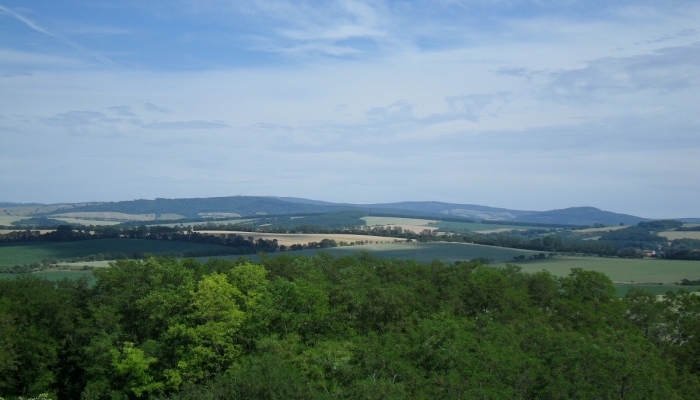
Lookouts: SE and E White Carpathians and Velká Javorina, SW Pálava Hills, NW Chřiby Hills with its villages, Strážov Hill and in case of very good visibility also Hostýn Hills and Vizovice Hills (NNE).
Since June 2014 there is an observation tower at the top of the hill.
Location:
Link to mapy.cz: www.mapy.cz
GPS coordinates: 48°55'28.608"N, 17°25'45.386"E

![]()
![]()
![]()